Proletarian Rage
boosted


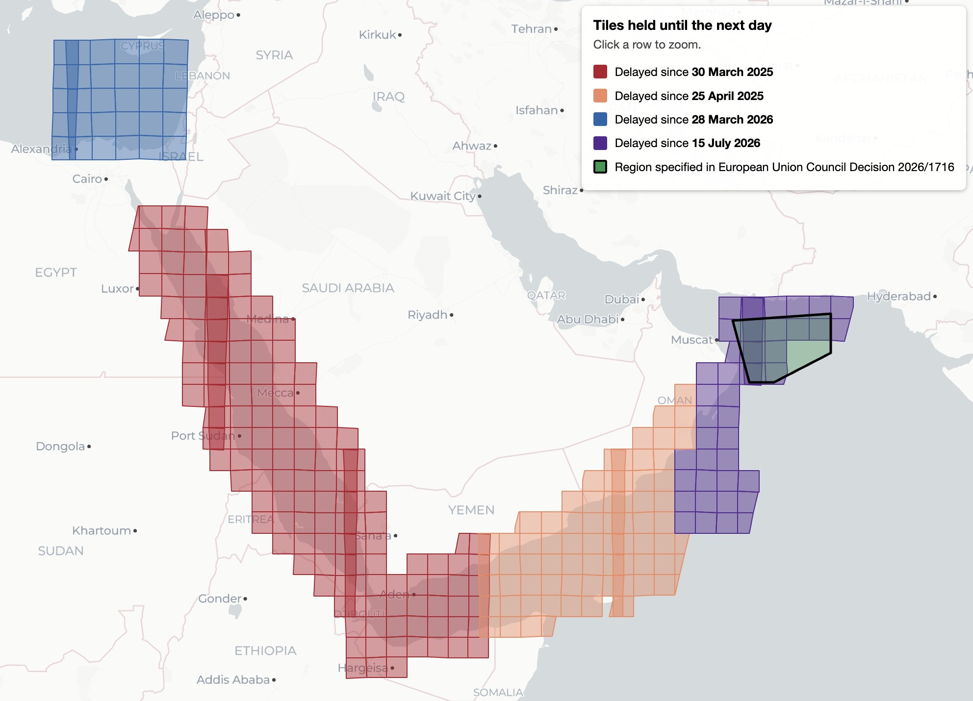
"Imagery captured by the European Space Agency’s freely available Sentinel-2 and Sentinel-1 satellites appears to be delayed over Gaza and parts of the West Bank, a Bellingcat analysis has found.
While the 24-hour delay on certain Sentinel imagery is a less severe restriction than other satellite providers have imposed, it can still impact the open source research process in fast moving situations. This is especially so in recent months as the European Space Agency’s Sentinel satellite data has emerged as a refuge as other satellite data is censored."
https://www.bellingcat.com/news/2026/10/29/eu-satellite-imagery-delayed-over-gaza-and-parts-of-west-bank-by-24-hours/
#Gaza #WestBank #Palestine #censure #satellite